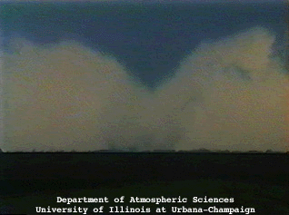
West Central Illinois residents may be experiencing a long-term weather pattern change in the Spring and the Fall. Climatologists and meteorologists as well as geographers at Northern Illinois University are suggesting a possible shift eastward in what is known as Tornado Alley towards portions of south-central Illinois.
State Climatologist Dr. Trent Ford of the University of Illinois says that the traditional “Tornado Alley” in Oklahoma and the Great Plains have seen an overall decrease in tornado formation and activity while regions to the east are seeing a large jump in favorable conditions for tornadoes. “At the same time [of the decrease in the Great Plains], this broad area that spans the Gulf Coast all the way up into North Central Illinois and even into Southern Iowa has seen increases in tornado frequencies and overall conditions that are conducive for tornadoes to form. The idea is that there is this shift [taking place] eastward and slightly northward in Tornado Alley, and that may be the case although, it’s difficult to say that necessarily that area is shifting as much as we are just seeing increases in tornado frequency as well as conditions that are favorable for the formation of tornadoes.”
Ford says what the shift means specifically for Jacksonville: “Pretty much all along I-72 into I-74, that corridor is kind of the northern extent of where research is finding significant increases in tornado activity. The largest is finding magnitude and total consistency are further south, actually in the mid South area of Illinois – really between Southern Illinois and Northern Mississippi. Those regions of the lower Mississippi Valley region is where we are seeing the most consistent and largest increases in tornado activity.”
Ford says that the state is seeing a trend in overall precipitation in the state. He says the modeling data cannot properly correlate the past several year’s extreme flooding to the increased activity. He says the research is still trying to bare that out. “These tornado trends and conditions of tornado frequency – is this actually an effect of climate change or is it some sort of natural variability that the shorter term records for tornadoes just can’t pick up on? This kind of remains to be seen. Certainly, the kind of systems that can generate extreme rainfall in the Spring and Summer are also those that can come along with more severe weather that can include tornado formation.”
National meteorologists have already warned against similar weather patterns as last spring with more predictions of high flood stages and possibly that will link to severe weather.


