

The National Weather Service in St. Louis confirmed one tornado touchdown in the WLDS/WEAI listening area from severe storms on Wednesday.
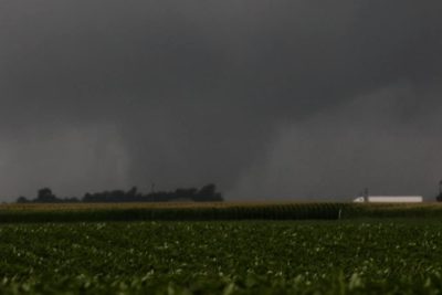
The tornado occurred shortly after 4:45 PM near Palmyra in Macoupin County. According to the National Weather Service they say that two storm spotters reported a tornado briefly touched down in a field with a verified picture. This tornado touched down Northeast of Hettick, IL, Southwest of Otter Creek. This tornado was short lived and did not do any damage, so there was no EF rating given to this tornado.

A second tornado happened in Western Sangamon County. This happened after 4:30 PM on Wednesdaty near Loami. There were reports of a brief touchdown that caused minor damage to trees in the area.
Tornadoes were also spotted near Farmersville in Montgomery and outside of Divernon along I-55 as a part of the system that moved through the area Wednesday. All of the tornadoes were given EF ratings of 0 due to a lack of sustained damage despite evidence of potentially violent winds.