

Another 1 to 2 inches of rain fell across the Illinois and Mississippi River basin Thursday afternoon, bringing about further problems for motorists and farmers in the WLDS/WEAI listening area.
Locally, Jacksonville continues to monitor Mauvistarre Creek at Corridor 67 between Chapin and Jacksonville and Route 78 north of town. The town brook at Foreman Grove Park continues to overrun, keeping access to Johnson and Brooklyn Avenues limited or closed.

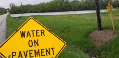
Further west, efforts combatting flood waters in downtown Meredosia appear to be successful for the time being. Local sandbagging efforts and more pumping will begin sometime Friday. Meredosia is expecting a a crest of nearly 27 and a half feet by Wednesday morning next week. Beardstown is beginning to see floodwaters creep closer to Route 100 near Indian Creek as well as at the Illinois River further north of town. The National Weather Service has upgraded Beardstown’s flood status from Moderate to Major yesterday, with expected crests Wednesday evening coming between 27 and 29 feet – more than 15 feet above flood stage.
To the south, Hardin, Kampsville, Nutwood, and Hillview are expecting higher crests with nearly 37.5 feet of flood stage expected Tuesday morning in southern Greene and Calhoun County. Illinois Route 100 is closed at mostly all access points into Calhoun County in and around Hardin, according to IDoT. Flood fighting activities have begun along Hurricane Creek in Hillview on the Greene County side, where they are also expecting higher crests.
According to data from the Army Corps of Engineers, the crests would be within the Top 5 ever seen in the area, and the highest that’s been recorded since the Great Flood of 1993. Wither more rain coming next week, river cresting forecasts may rise once again.